
Record Warmth to Tuesday Snowstorm Zeroing in, Sun Flares
Related Articles
Peeps,
I told ya all it could be record breaking weather and temperatures Saturday which it did. It hit 61* here in Hillsdale, felt like Spring and the birds were singing and children were playing – inside as per this generation – and the bears were dancing up the tree!!
Extreme weather is abounding and do not be OMG it’s going to snow Tuesday and it was just 61*??? Yes, it’s called weather extremes and we are in it and its going to ramp up as our magnetic pole shift increases, solar and earth cycles start to converge. Anyone remember 2014 Super Bowl NJ style snowstorm that I called for 5 days out and it was 51* the day of the Super Bowl and we had a snowstorm that night stating at 11PM just after the game only to strand tens of thousands of fans?? The pro mets played it off the whole time as station managers and that robust demons Christie gave an order for such for the good of the business? Yeah that is looking to repeat but just 24 hours later than 2014. Hey, I cannot make the weather but help interpret what the models are showing. The weather will do what it wants to do and you me nor CO2 can do nothing about it, it is like our life all in God’s Hands!!!.
A REVIEW MY ESTUDIANTES
MY CALL FROM 2 DAYS AGO:
“Details are still 3 days away which is an eternity for a storm. If it were tomorrow or Sunday that would be locked in but the storm is there and any 25 -50-mile shift can mean Coating to 2″ to 6-12″. Yes, that’s how intricate this storm is. These storms are never that easy.”
Storm in a nutshell – Atlantic City we need you!!
Everybody root for #1. If not – YOU’RE BANNED!!
NATIONAL WEATHER SERVICE SNOWFALL FORECAST

URGENT – WINTER WEATHER MESSAGE
National Weather Service New York NY
335 AM EST Sun Feb 11 2024
CTZ005>008-NJZ002-103-NYZ067>070-112100-
/O.CON.KOKX.WS.A.0002.240213T0600Z-240213T2300Z/
Northern Fairfield-Northern New Haven-Northern Middlesex-
Northern New London-Western Passaic-Western Bergen-Orange-Putnam-
Rockland-Northern Westchester-
335 AM EST Sun Feb 11 2024
…WINTER STORM WATCH REMAINS IN EFFECT FROM LATE MONDAY NIGHT
THROUGH TUESDAY AFTERNOON…
* WHAT…Heavy snow possible. Total snow accumulations of 5 to 9
inches with amounts upwards around 10 inches possible across the
higher elevations.
* WHERE…Portions of southern Connecticut, northeast New Jersey
and southeast New York.
* WHEN…From late Monday night through Tuesday afternoon.
* IMPACTS…Travel could be very difficult. The hazardous
conditions could impact the morning or evening commute.
PRECAUTIONARY/PREPAREDNESS ACTIONS…
Monitor the latest forecasts for updates on this situation.
Winter Weather Advisories will be put up later today for Eastern Bergen County. Southern Passaic County and such regions.
From my man Will C!!
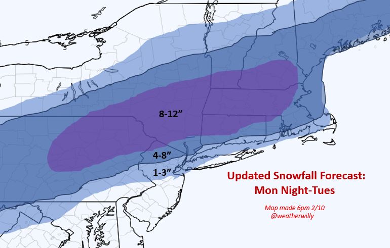
White chalky area is gonna be a lot of sleet/mixed precip. Just North of it it may puke snow!!
Problems are not an arctic air mass, ground is warm and we’ve had no luck the past two years with snowstorms – the tri fecta of woes.
Once this puppy gets off the coast it’s going to crank and may actually bomb out where New England may see a blizzard or blizzard like conditions!!
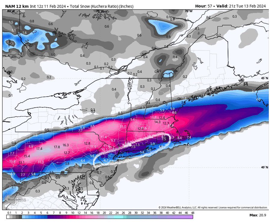
It will start as rain around 10-11AMish Monday night and then transition over to Sleet and then snow by about 4-6AM for most of NNJ. Then it should snow until about 3PM from west to east.
PB land, Guerci land, Britt’s abode, KJ Yorktown and Quinner pad will get smoked with 6-8″ maybe 10″ !!
As I said to my wx club yesterday …. We just have to get snow on the ground then things will feedback off it and help adjust the intricacies in the pattern!
SOLAR Relentless
President Day History repeat??
PD3 snowstorm setting up?

Have a great Sunday.
Updates to come peeps.
