
Storm Verification, Ice again Monday morning commute!, BRUTAL COLD TUESDAY MORNING
Related Articles
Peeps,
Storm Verification
Well my dear weather weenies and most important my snow/winter weenies did I come through or what this time as I warned on Wednesday morning ice for the commute. Spread the word my good people to those who want to be in the know for the show that Big Momma is going throw at us.
Radar last night at midnight
Well now, wasn't this fun? Ok points around I-95 & east, enjoy the upcoming fireworks. Glad I got a taste of the best banding before it treks your way. pic.twitter.com/hJE2VWMjfH
— Mike Mostwill (@MikeMostwill) January 7, 2022
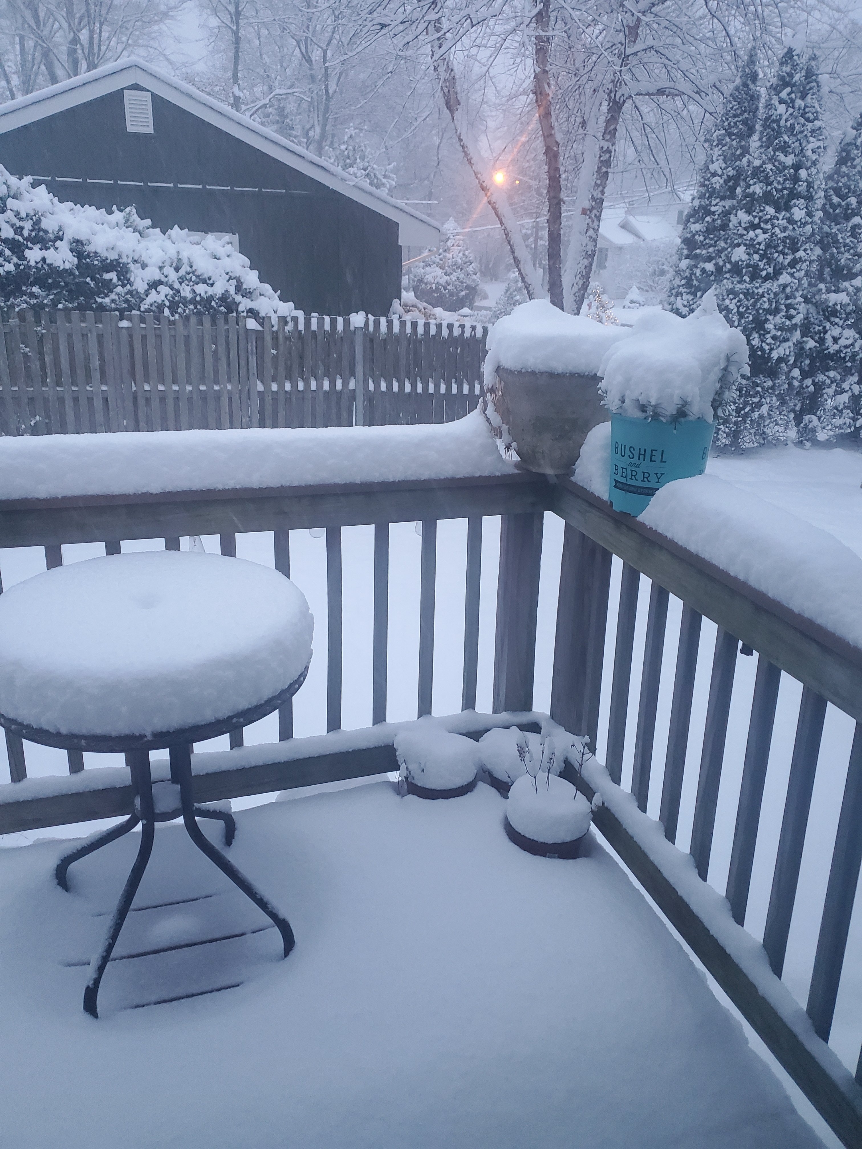
My yard this morning at 7:30 after I awoke not thinking we were off – 6″ of White Gold or as “Heavy D” says Global Warming Goodness!!
As I explained to my Wx Club members who are a great bunch of young people that the snow ratios would enhance the snowfall (were 20:1 not the 10:1 that snow maps were spitting out as the TV mets) amounts. Leah, Gee gee Johnson, Alexa, Ava, Chloe, Zach all learned about the storm track adn how to use the isobars on a weather model map to help with teh track and guess what….NAILED IT!!!

...New Jersey...

...Bergen County...
Closter                      7.3 in    0820 AM 01/07   Public
1 NNW Lyndhurst              6.0 in    0830 AM 01/07   Public
East Rutherford              5.6 in    0853 AM 01/07   Trained Spotter
Fair Lawn                    5.4 in    0700 AM 01/07   Public
1 WSW Washington Townshi     4.9 in    0930 AM 01/07   Trained Spotter
Westwood                     4.8 in    1014 AM 01/07   Trained Spotter
Ridgewood                    4.7 in    0758 AM 01/07   Trained Spotter
1 NE Franklin Lakes          4.3 in    0800 AM 01/07   Trained Spotter
Mahwah                       4.0 in    0700 AM 01/07   Public
2 ENE Park Ridge             3.9 in    0915 AM 01/07   Trained Spotter

...Essex County...
West Orange                  6.3 in    0809 AM 01/07   Public
North Caldwell               6.0 in    0800 AM 01/07   Trained Spotter
1 SSW West Caldwell          6.0 in    1030 AM 01/07   Public
1 NNE Livingston             5.0 in    0920 AM 01/07   Public
Essex Fells                  5.0 in    1020 AM 01/07   Public

...Hudson County...
Harrison                     6.0 in    0800 AM 01/07   COOP
1 ENE Jersey City            6.0 in    0830 AM 01/07   Public
Harrison                     5.7 in    0715 AM 01/07   Trained Spotter
Kearny                       5.5 in    0900 AM 01/07   Cocorahs

...Passaic County...
1 SE Wayne                   4.3 in    0840 AM 01/07   Trained Spotter
Norwood measured 9″ and it was verified!!
Also, we got the phone call as did so many – SCHOOLD CLOSED baby we had a:

He was very happy and will be around through the end of January – BUCKLE UP!!!

Or as my man Meizy’s would say to me and PB from the hinterland!

Ice again Monday morning commute!
Peeps for the love of God heed this warning and if your and admin please do not make the same mistake as what happened on Wed morning. If you believe God gave a proclamation to a prophet that we would have many ice events/storms this year all over the world and lastly NYC would have a crippling snowstorm – that’s coming soon as well.
Details to come but just now this si on he table and teh soundings are not good.
Delay?
Time will tell.
That’s freezing rains and sleet for EPA, NNJ, HV and CT – pink and purple colors are that.

BRUTAL COLD TUESDAY MORNING!!!! MASSIVE ARCTIC
BLAST!

