
BARNEY VERIFIED FOR NWNJ; BARNEY ALLEEEEET #2 ELEVATION AREAS!!
Related Articles
Peeps,
BARNEY VERIFIED FOR NWNJ
Yes teh elevation areas had 4-6″ of snow which is Barney level and they had a good dose of snow. Here today gone tomorrow in March. Wet pasty snow. I had.5″ here in Hillsdale, missed the amounts herer and many otehr areas so I give myself a C on this storm. This winter has been abyssmal.
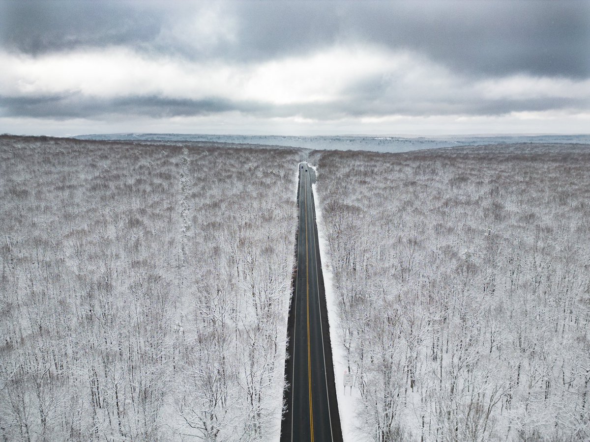
Poconos
BARNEY ALLEEEEET #2 ELEVATION AREAS!!!
Folks,
From a pro met:
If you live in NW NJ, NEPA, the Catskill region and Lower-Mid-Hudson Valley (at any reasonable elevation 500′ and up)……get the yardsticks out?!
Anyway, I haven’t looked at the hemispheric or tropical mechanisms, but what I’m seeing in H850 through H5 has my alarm bells going off a DEF-CON 5 for an over-performer that models will not see until it’s too late. The 12z long-range HRRR actually looks closest to what we should see on radar regarding the QPF field, assuming the presentation aloft is correct. Also, don’t chase that eastern vort max – it’s feedback. And that is really messing with the models right now. The main show is the parent vorticity diving southeastward, not that lead disturbance. With such a negatively tilted trough aloft super-imposed on the intense frontogenesis beneath it, a prolonged period of symmetric instability should allow pretty prolific snowfall rates of 1-3/2-4” per hour in the areas I mentioned above. Couple that with ratios of anywhere from 15-20:1 (yes, you read that right) for the zones I mentioned, I think 20-30” amounts should be achievable. Again, this is based on some very crude posturing, but this storm is not to be trifled with. It’s not often you see troughs go THIS negative before closing off and maturing, so the atmosphere is gonna do some wild things. Also, don’t be surprised to hear thunder and see lightning with this.
We live atthe edge so we are not in this zone BUT we could see a good 6″+ if things go right and teh model are correct. Lots of moving parts to this dynamic storm. It will start as rain and then transition overnight to snow as currently modelled. Time will tell but this is the anniversary pfo the great 1993 Superstorm!!! Yes weather loves to repeat itself or at least rhyme!
Purple is 6″+ of snow, how much sticks to roads is going to be less but time will tell:
Frim a great wx mind: Weather WIlly
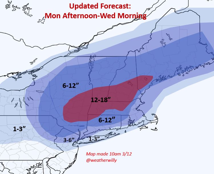
Start Time: Monay evening as rain for the area
Monday night it transitions to heavy wet snow.
Accmulatiosn can be a slushy 1″ for NYC and Metro Urban raes to as much as a foot in elvated regions like Sparta, West Milford and 3-6″ below those areas like NW Bergen and Passaic Counties into Rockland.
Ending: Tuesday later afternoon/evening
This is a dynamic coastal storm so we’ll have to see how things play out because the slightest shifts can again mean a foot for many in NNJ, LHV, EPA and ECT and or a couple of inches. IF we had a true arctic air mass this would be a shut down storm easily.
Enjoy your Sunday’s!! God Bless and let him guide you through these days ahead. Things are getting wilder as we head into 2023 economically (bank closures, stocks going to get slammed even further, politically and massive distractions inbound due to the truth being exposed about so many lies – Jan 6, VID, Vax – no its a nefarious planned shot, wild weather)
CALIFORNIA ANYONE:
MARKET CRASH ALERT: Lines from at FIRST REPUBLIC BANK in Los Angeles..
ANOTHER ONE?
— Chuck Callesto (@ChuckCallesto) March 11, 2023
South Lake Tahoe, CA. Removing over 8 feet of snow from the roof while the backyard depth is the same height as the garage roofhttps://t.co/V1hGP1027W pic.twitter.com/fOctBLbKLu
— Ralphs Weather OBS (@WeatherNut27) March 10, 2023
March 9, 2023
California Statewide Snow Water Content
Percent of Normal for this date
.. North = 157%
.. Central = 199%
.. South = 230%
.. State = 194%https://t.co/nBGc0pmUFD pic.twitter.com/vQc4BNsimT— Don Penim (@Don_Penim) March 9, 2023
@NorCalWeather @JimCantore
The Worlds largest snow blower, a Union Pacific RR Rotary snowplow churns through ten foot deep pack a few miles west of historic Donner Pass in California High Sierra. New snowfall today brings the seasonal total to 600” in the top 10. pic.twitter.com/RHGBqscO9V— Mike Pechner (@NorCalWeather) March 7, 2023
Updates to come!
AL Q
