
HAPPY NEW YEAR!! WHERE’s WINTER?? SSW
Related Articles
Folks,
Happy New Year!!! I wish you all great health, happiness, success and prosperity in this last year of this decade – WOW!!
WHERE’S WINTER ??!! LIKE WHERE’S WALDO?
 more like
That is a question that has frustrated the ever living hell out of me, my snow weenie friends here and beyond, many other weather enthusiasts from various weather boards/forums and pro meteorologists that I know. The Mammoth December that was being portrayed by models and indices was totally derailed around Dec 13-15th and we went into an above normal and rainy period where the cold air would escape as the storm approached with storms cutting to our west leaving us in the warm sector, southerly flow sector. Plain and simple I BUSTED and I have big 49 year shoulders to take this. So what happened ??
We have a SSW – you know the one I was harping on last year before Xmas and the snow we’d see xmas eve – yes I had a nice coating on teh ground but quickly melted by about 11AM – dam heat miser LOL!! – back to the SSW which means a Sudden Stratospheric Warming where we have a tremendous amount of heat flux rising high into the stratosphere. Here is a cross section of our atmosphere:

Our weather is in the Troposphere but is directly influenced by the happenings if you will in the Stratosphere.
SO why is this important ? We had a snowstorm back in mid November right and missed a bigly storm Dec 5th that crippled the South and the rest was rain form that point forward overall. The tremendous amount of heat from the Scandinavian Block that helped prodcue these storms released a great amount of heat up into the pole region and heat roses right. We also had a Pacific Jet coming off the Asian continent that was flooding the NA continent with Pacific Air which is not cold. Congruently we had a East Asian Mountain Torque in the Tibetan Himalayan Region that was positive and this also released upward motion of heat flux into the pole ward region. With these atmospheric developments a very large SSW was taking shape and this heat was actually hindering our pattern from being one of great. It then allowed convection of thunderstorms to build in the Indian Ocean which caused the MJO cycle to be in the warm phases and get stuck in them thus hurting our weather pattern from cold adn storms to warmish and stormy!!
So I have outlined the why this occurred and NO ONE AND I MEAN NO ONE SAW THIS COMING. If they did they are fake news and Liars yes Liars. This event – SSW _ once it finishes in the next few days will and yuo will here this all over crush the Polar Vortex similar to last years that brought us winter from March 4/5 to April 10th in NNJ with 30″ plus of snow and 4 Nor’easters affecting us – recall that??
Going forward
It will be warmish the next 5-6 days and then we’ll see winter start to ocme back and by mid month it should be in full swing by about the 9thish.
Here is my post from the NJ Strong, USA and 33 Rain Wx broads I made on this 1st day of the 2019!
The models are in a great state of flux a this time with a MAJOR Sudden Stratospheric Warming (SSW) event ready to crush the Polar Vortex in the stratosphere down through the troposphere.
What I have learned from these events are no two are alike and these are preceded bu AN temps in teh mid latitudes – our region. The greater the AN temps the direct correlation to the greater the SSW event as has been noted in research.
Now I know some will want to throw stones at me…………….you cant reach me – nah nah nanny poo poo – LOL BUT with that being said once we see the down welling, and IF the models are correct with the three headed vortex monster split which as bring back 1963 -64 from another has explained in great detail said once it does then we will see a major flip that could last for a 45 period ala 1977-78.
From Dr Cohen:
https://twitter.com/judah47/status/1080126292891181059
Jan 9-10th time frame is to watch as well – the NATL and NPAC look to be in a more favorable response and set up as we have the MJO going to phase 7 and the SCAN Blocl retrograding into the East of Greenland:

This is a great look for the stratosphere and our sensible weather
Enlarge this image Click to see fullsize

MJO Foercast:
BOMM

GEFS

The plots show the LP (blue areas are lower pressure) moving more east into the more favorable phases:

They show the MJO in phase 6 until as Isotherm says Jan 3/4 th and then into phase 7 which is a more favorable phase for us in this area – the response lag is usually a few (3-4)days
EURO: which has been struggling with the MJO – take ablned and we are in a good shape
.gif?w=900&ssl=1)
Lets use the GEFS for these indices since the coupling effects will be translated a lot more in line with what is happening
AO – goes Negative + cold air intrusion into our area
Enlarge this image Click to see fullsize

NAO – blocking – goes Negative = cold air gets locked in and storms slowed
Enlarge this image Click to see fullsize

PNA – spikes Positive – allows coastal storms and others to travel pole ward or more Northerly as the flow in the jet changes from west to east to more SW to NE
Enlarge this image Click to see fullsize

OUR FRIEND MR. EPO – this has been our major winter driver in 13-14, 14-15
going N which will help with a cross polar flow:
Enlarge this image Click to see fullsize

So we have good signs coming and I think our transition starts around the 7th – 9th time frame (+1 day)
Back to simplicity – what does a SSW mean? The Polar Vortex gets elongated knocked off the North Pole region or it splits. The forecast is for a King Ghidora type split =
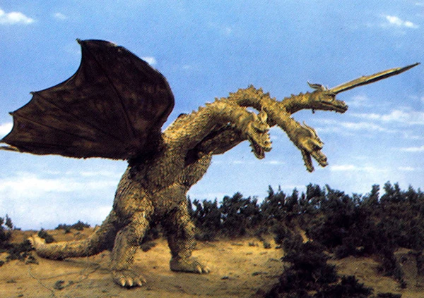
Yes into 3 vortices which woudl be pretty incredible. One is forecasted to set up over Hudson Bay and the Newfoundland regions which would usher in Arctic cold, not brutal but very to cold overall and the jetstream would look like this:


SNOW CHANCES:
Thursday AM – light coating NW areas and NNJ

Jan 9th time frame
Jan 13-15th time frame as per high energy sun cycle from Jim Witt and incredible long range forecaster
Solar Update
2018 total: 221 days (61%) WOW – affects will be coming – more cloudy days = cooler days
Volcano Eruptions:
Very active tiem frame right now with a VEI 3 level Indonesia spewing ash and gasses 5 mile sinto the stratosphere – affects to ocme from this and many other volcanic explosions last year.
Updates to come:
Al Q
