
SNOWSTORM Recap, Powerful Storm, Brutal Cold inbound in CONUS
Related Articles
SNOWSTORM Recap
Heavy front end thump then for parts of NNJ a quick changeover to a mix then a lull then back end snows until about 2pmish maybe 3pm since the model stops at 1PM below. I think it is running a tad too warm and the mix only makes it up to between I78 and I80 corridor.
Start time: 3pmish is on track
Actual: (Started at 3PM for Morris Cty into Passaic, I started at 3:40)
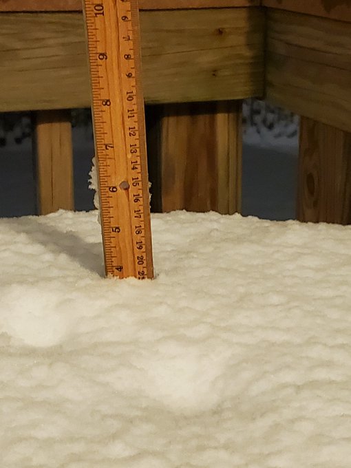
Snowfall amounts:
NYC Metro -2-3 maybe 4″” (yes the streak will be broken but it may happen again!!)
Actual : (only.2 – .5″ max but just outside recorded 2″)
S Passaic & N Bergen CT – 4-8″
Actual: (Low end was reached of 4-4.5″)
W Passaic County, N Morris County and Sussex – 8-12″
Actual: W Passaic recorded 6″ but Sussex recorded from 10-14″)
CNJ 1-2″
Actual: (Recorded 2-2.5″)
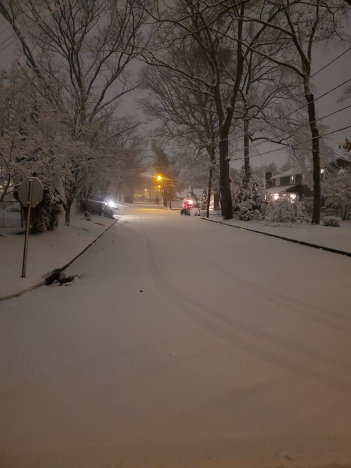
Wrap around snows Sunday morning and snowed until 1PM ish was spot on – too bad it was 34* . If it was 32 or 31 degree we would have picked up another 1.5 – 2″ easily.
Snow ratios were pathetic for January at about 7:8 to 1 instead of 10 or 12:1. You would see this in early to mid December and in Mid to late March
Grade ??? B+ overall
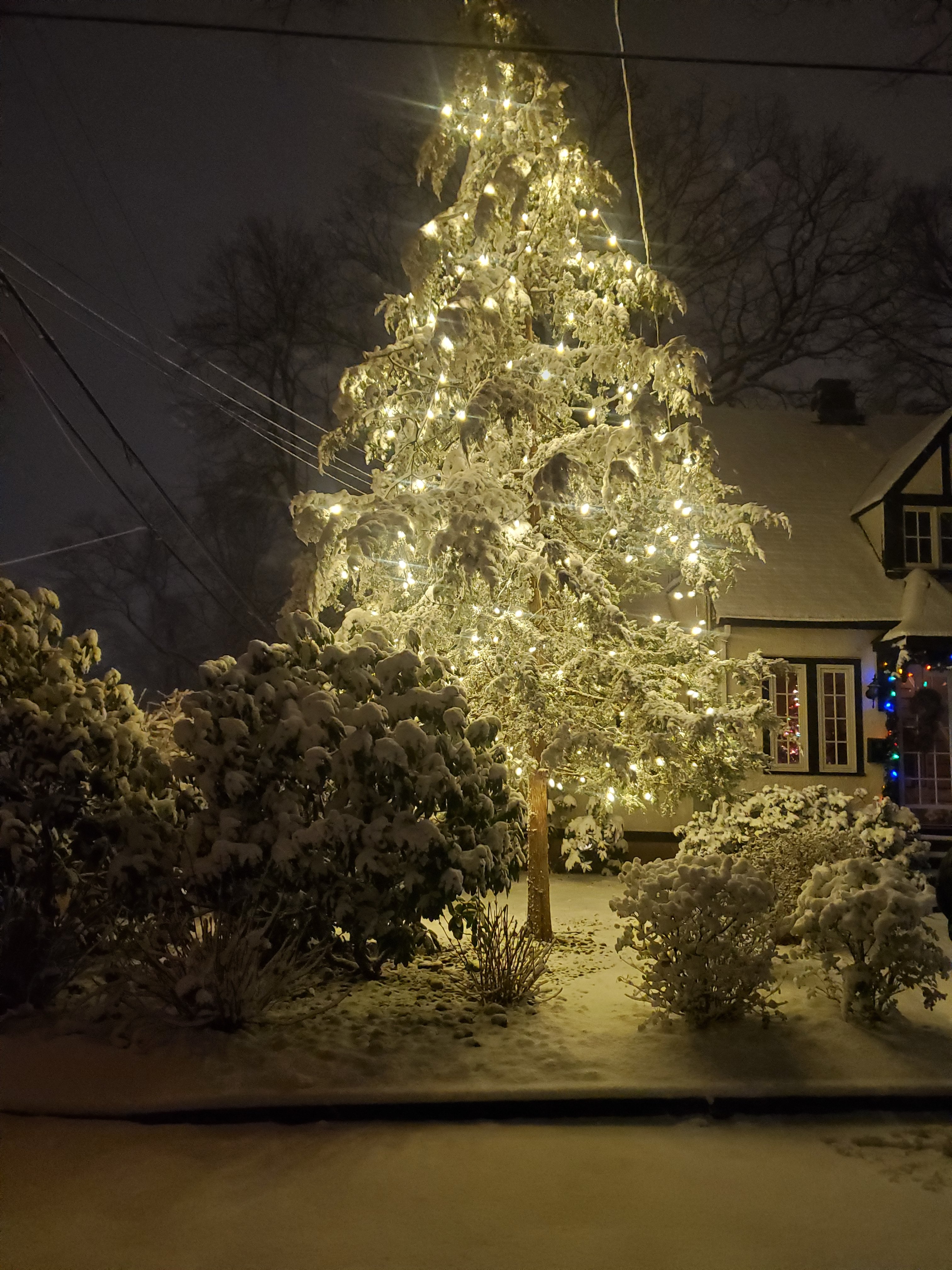
It was majestic and absolutely beautiful as my wife, son and his gf took a walk in our neighborhood. To hear the silence and snow falling is indescribable to me, just something about it.

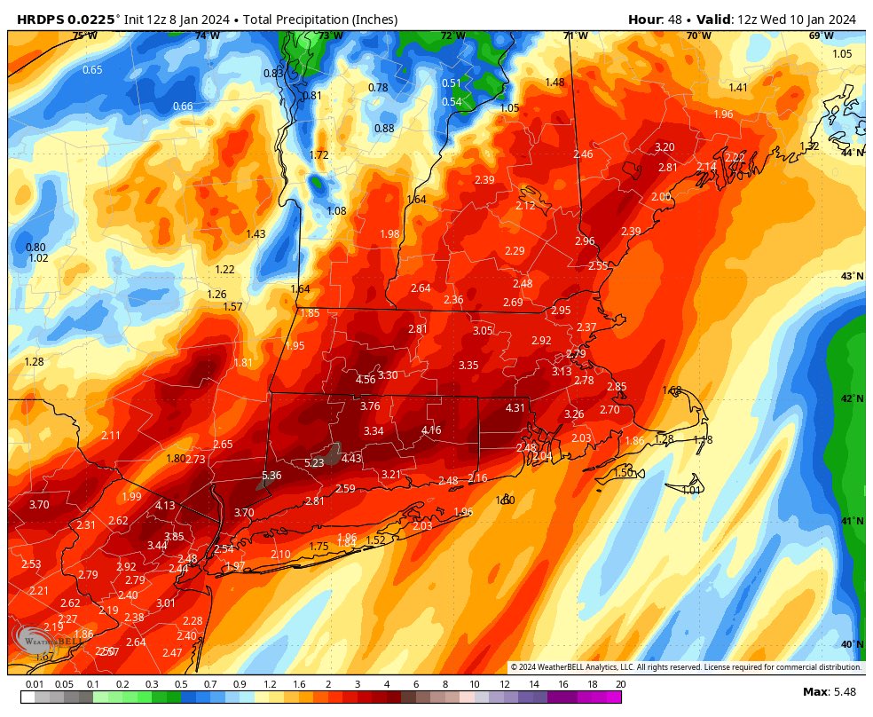
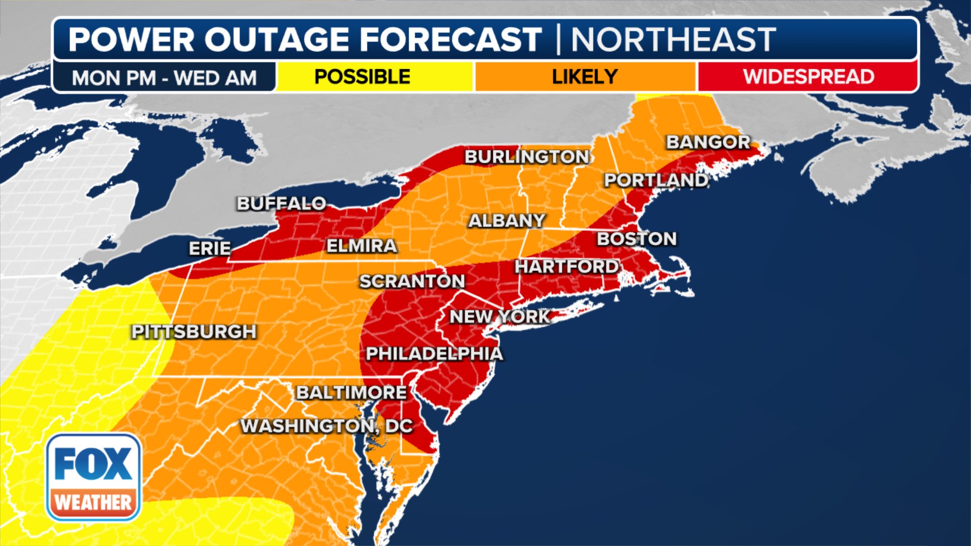
Powerful Storm
Tuesday evening into Wednesday morning:
Rainfall: 2-4″ Flash Flooding/River Flooding expected
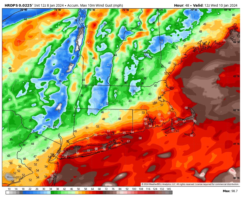
Winds 20-30MPH sustained with gusts 40-50mph
Coast will see 30-40mph winds with 55-65/70 mph wind gusts are possible
Coastal flooding: Moderate to Major Possible 2-4′ above tide
Even if you deduct 20/25% off this map it is still majorly strong winds
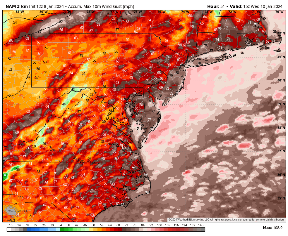
Conservative RGEM model low end winds are concerning – I used this as my forecast!!!
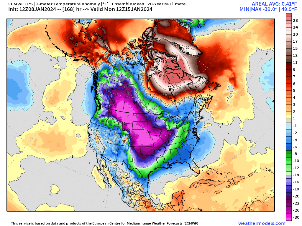
BRUTAL COLD inbound
Texas, Tennessee and Louisiana – people will die from this cold!
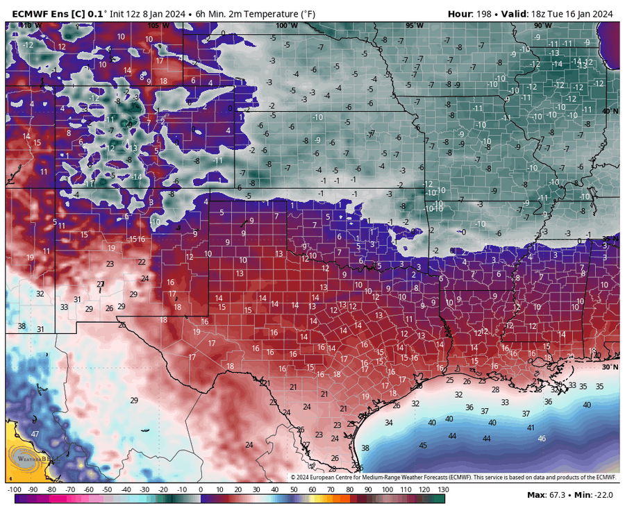
Rimland – shiver me timbers!!
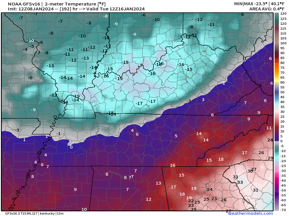
This is unprecedented cold air – record breaking type
How cold??
-50’s for low temps in Montana
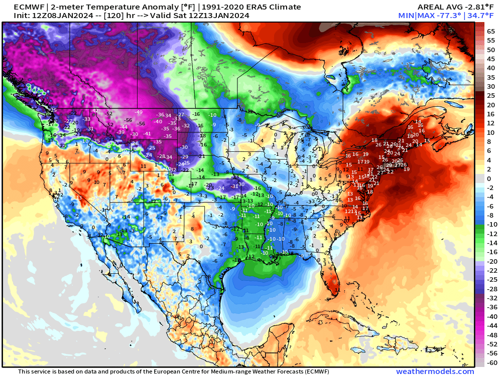
Progression

Prepare for the extreme weather peeps, we aint seen nuttin’ yet possibly??
Prep that generator and sump pump!
Updates to come.
Al Q
