
WARNING!!! SUN HALO = BOOM!!
Related Articles
Peeps,
On vacation, and cell phone, making 2nd post from the 4th floor of my hotel here in Wild…wood. and ots going to get wild here in about 6 hours. 60.mph plus Winds and driving rains with possible power outages.
Those of you in NNJ have got the PRE storms, rain and ….gild size ball hail. Peeps welcome to the Grand Solar Minimum. It not you, nor me nor CO 2. If you believe other wise we’ll you’ll be…..fluxed!!! Hahaha ha!!
From what I sent my peeps this morning as I was soaking in the final rays before Elsa decides to literally rain on me party!! No SLEEP TILL…..BROOKLYN!! Father’s mothers family from there as is my wife’s!!
Momma Z loves this era!! 80’s = booom!
From what I sent out earlier this morning.

The strongest winds from Elsa are most likely to occur late tonight and Friday morning over Long Island and coastal sections of New Jersey and Connecticut, where the Tropical Storm Warnings have been issued. Sustained winds could be between 40-50mph with gusts up to near 60mph for at least a few hours, as Elsa’s center passes nearby. These winds could cause tree damage and power outages. Around New York City, winds are likely to be between 20-30mph with some gusts to up to near 40mph possible.
2-4″ of Rain
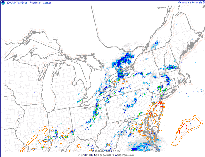
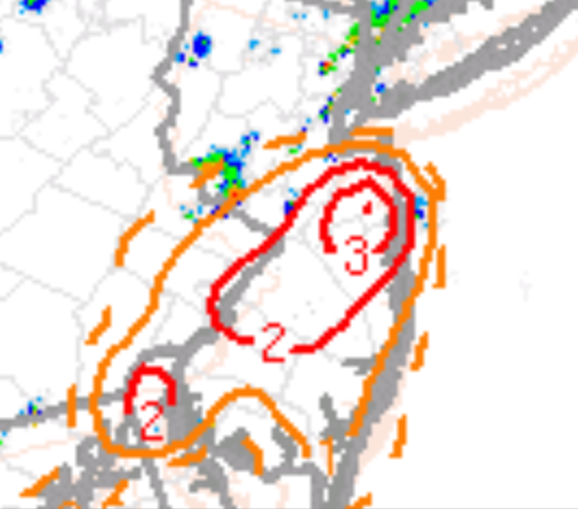
NNJ peeps but then this:

HWRF ups the ante, doesn’t cave east. Instead expands the 850mb low west. Brings an even more robust LLJ/convective tail into the NJ coast/pushing inland. This frame of course after this feature rakes DE/MD/SNJ & then pushes up through the metro.
While most guidance is focusing on a swath of heavy rain (esp the HRRR/HREF) from CNJ up through the LHV into SNE, with a cutoff sharp to the west… That axis is likely to still shift slightly though which would either bring WNJ into the heaviest stuff, or skunk em. Conversely, a slight job east & NYC finds itself on the periphery of the heaviest rains instead of being right in the bullseye.
If it’s true not good.
ALL FROM 33 & RAIN WX BOARD !!
And then this on the beach which I HAVE NEVER SEEN!! This has not been seen since… the MAUNDER MINIMUM back in the 1700 and early 1800’s!!! Sick


Hometown hail storm !!
@weatherchannel
Crazy hail storm in Hillsdale NJ pic.twitter.com/V1pAtAk79U— kencpo (@kencpo1) July 8, 2021
Till 9PM tonight

